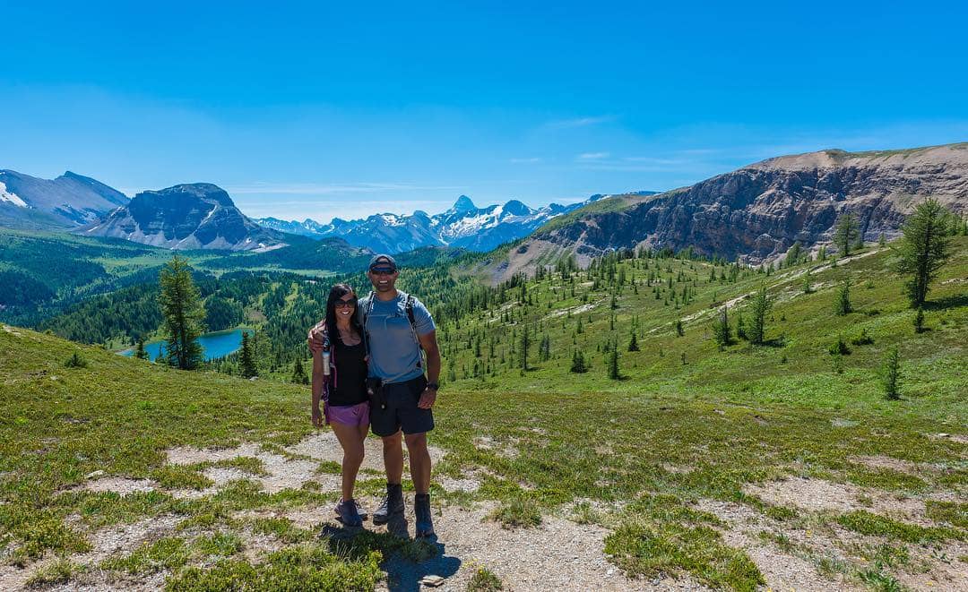
Carpeted with a dramatic series of jagged mountains, sun-kissed alpine meadows, and stunning lakes, Banff is a heaven on earth when it comes to hiking. With over 1600 kilometers of trails taking over the Banff National Park and its surrounding area, Banff will have both beginners and professional hikers spoiled with choices.
There are some easy, scenic hikes such as the Lake Agnes Tea House and Sunshine Meadows that guarantee jaw-dropping views. Meanwhile, Banff also has some strenuous hikes that may take a day to complete and require more experience to deal with mountain hazards.
As far as hiking and warm weather go, the best time to conquer the trails of Banff is from early June to mid-October. Wanna know what’s in store for you? Check out these 7 best hikes in Banff that we break down from easy to more challenging hikes.
1. Lake Agnes Tea House Trail
- Distance: 7.4km
- Elevation: 435m
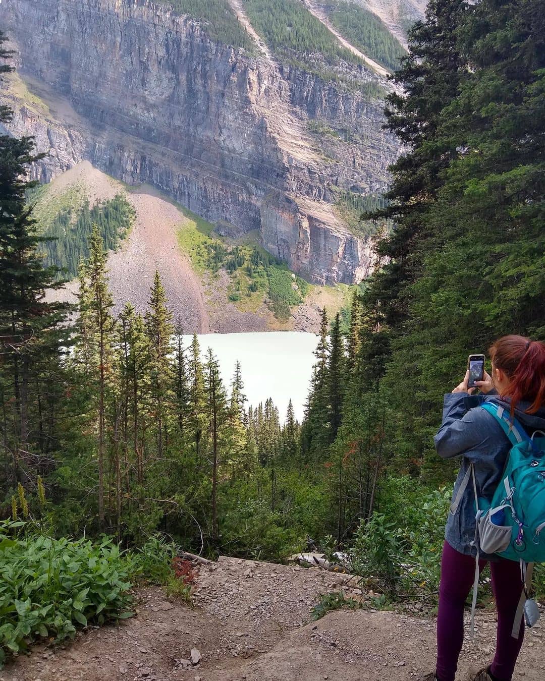
Let’s start with an easy call. The entire hike back and forth takes about three to four hours to complete. The scenic hike steeped in the mountain slope is one of the most popular hikes in the Lake Louise region.
The trailhead starts with a small incline and remains this way throughout the hike, with Mirror Lake being the first scene you’ll encounter. From there, the hike opens out to the famous Big Beehive which is a dramatic, giant rounded massif before you go to Lake Agnes.
This turquoise lake lies at the foot of a lush mountain. On the way there, you’ll immerse into a deep green carpet of shrubs and moss while the scents of wildflowers and twittering birds dance in the air.
The wide and well-marked trail allows you to spread out to other paths that are wheelchair or strollers-friendly. Once you get to the base of Lake Agnes, kick back with lunch under the trees, read a book, or treat yourself with good eats at the historical Tea House which is open from June to October.
2. Sunshine Meadows (Rock Isle, Grizzly, and Larix Lake)
- Distance: 7.6km
- Elevation: 175m
Sitting at 2200 meters above sea level, Sunshine Meadows serve as the base of numerous hikes of different lengths and difficulty levels.
But if you don’t want to put too much stress on your cores while still guaranteeing the best views of the valley and lakes, stick to the loops circling Rock Isle Lake, Grizzly Lake, and Larix Lake. Each of them is a gentle hike with a rewarding 360-degree view over the abundant fields and flowers.
The loop around Rock Isle lake takes 90 minutes to complete, starting at the Sunshine Village Nature Center going on through the alpine meadows and a fork in the road. The Rock Isle Lake viewpoint will be there when you go downhill after passing the Citadel Pass.
The Grizzly and Larix Lake take a little longer to complete. If you have another four hours to spend, keep walking once you reach the Rock Isle Lake viewpoint for the next 200 meters until you see a junction.
From there, take either the left or right trail to see both of the lakes. Along the way, you’ll encounter a shoreline leading to the Simpson Viewpoint.
Looking for a place to stay in Banff?
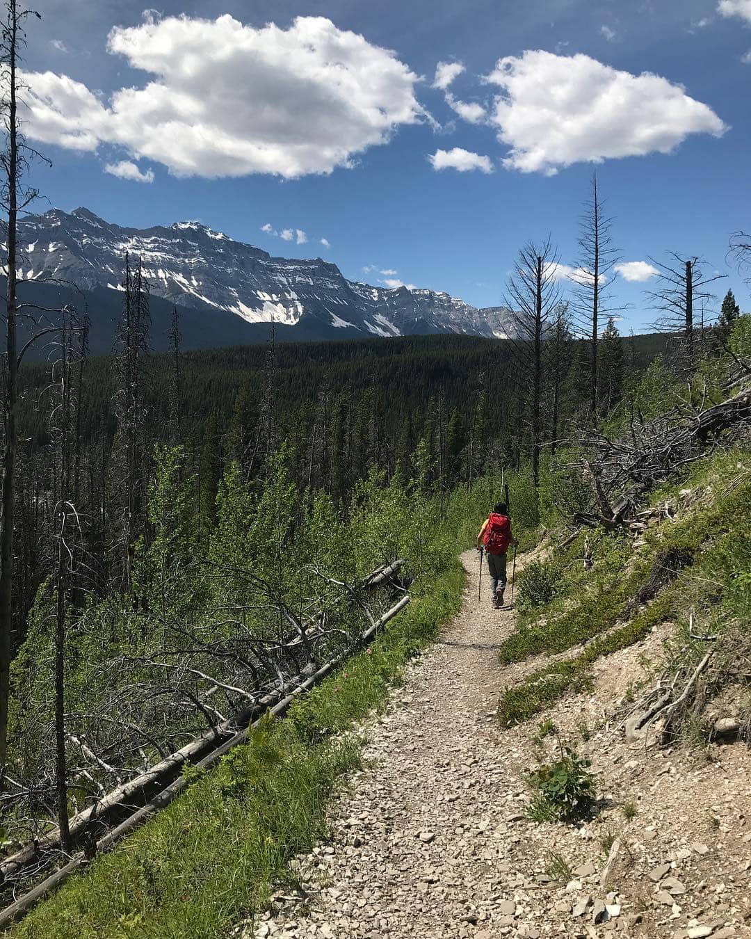
3. Redearth Creek Trail to Shadow Lake
- Distance: 27.5km
- Elevation: 1017m
If you’re ready to take on a long haul of the hike which takes over half a day to complete, drive 20 kilometers west of the Town of Banff towards the Redearth Creek parking lot to start at the trailhead.
Since the hike has fewer people and chances are you may encounter bears, you need bear spray and bug spray before starting.
The Redearth Creek to Shadow Lake is suitable for both hikers and bikers, featuring an old, tree-fringed fire road followed by an easy-to-follow section. Redearth Creek to Shadow Lake is a nice long excursion but it has fewer beautiful views compared to some other routes around Lake Louise.
However, you’ll surely catch some until you get to the endpoint which is looking over the lakeshore. In winter, the trail becomes a popular spot for cross-country skiing.
After the first 7 kilometers, you can stop at the Lost Horse campground. Stop here for an hour lunch before moving on to a signed junction within the next 10 kilometers. The Shadow Lake is northeast off of a fire road before ending up at a lodge.
4. Cascade Amphitheatre
- Distance: 13.8km
- Elevation: 924m
This hike gives you a good exercise with a stunning view to inspire your outdoor workout. While the Cascade is considered one of the easiest scrambles in the Banff area, the mountain hike poses hazards that you’ve gotta come prepared before venturing out.
The trailhead to the peak begins at the Mt. Norquay ski lodge at the far end of the parking lot before you finally reach the Cascade Amphitheatre Meadows.
The Amphitheatre is a massive basin with a gorgeous curve where you move on towards the skyline of the cliffs on the right side of the Amphitheatre.
It gradually increases the elevation gain by 640 meters until you contour up the right side of the First Peak. At this point, the weather may and visibility may shift so make sure you keep a close eye on the ascent route for landmarks in the descent.
The hike is mostly forested but it also guarantees some viewpoints such as the Mouth Louise to the west. The best time to hit the hike is during summer when the alpine meadows are peppered with wildflowers.
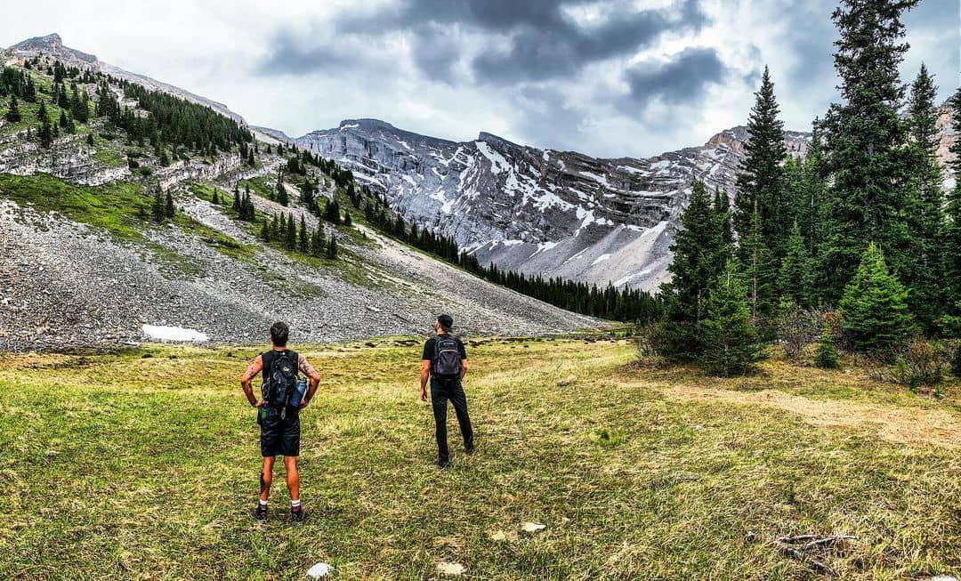
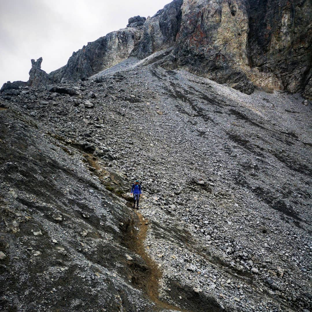
5. Edith and Cory Pass Circuit
- Distance: 14.3km
- Elevation: 1075m
To take on the Cory Pass, you need to put some great effort into the hike as it’s known as one of the most demanding and challenging day hikes in the Canadian Rockies. Start the trailhead at the Fireside Picnic Area which is 9 kilometers away from Banff.
To prepare for the hike, you need roughly 8 hours to complete depending on your fitness level.
The first 7 kilometers run uphill with about 1100 meters of elevation gain. You’ll encounter a very steep section within the first 500 meters. However, it should loosen up and leave you with an easy, well-trodden path in the forest until you reach a fork. When you get out of the woods, you’ll encounter a rocky path that slightly goes uphill.
From there, the views become splendid, overlooking the Banff township, Mount Cory, and Mount Louis. The Edith Pass is not far away from there, leading you downhill on a tricky path with loose scree and stone cairns along the way.
Wildlife and bears are a common scene here. Plus, the hike is completely exposed to the winds at some sections so make sure you layer up!
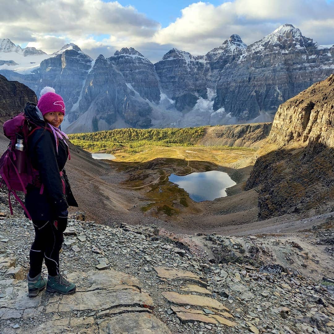
6. Sentinel Pass via Larch Valley
- Distance: 11.1km
- Elevation: 799m
Sentinel Pass is one of the most scenic hikes in Banff, starting at Moraine Lake, passing canoe docks and a series of golden larches and peaks behind you.
The beginning of the hike is a well-trodden switchback path up to Larch Valley with no views. But as soon as you get to the Eiffel Peak, the views open up with the gorgeous sun-kissed peaks and lakes that emerge in front of your eyes.
The Larch Valley is the most stunning in autumn, with the alpine meadows surrounding Mount Faye and Minnestimma Lake sprinkled with soft pink sunlight.
From there, you’ll see the summit of Sentinel Pass that you can reach after 30 minutes hiking. This is where you can marvel at the Ten Peaks and the Paradise Valley before hiking back on the same way.
If you have more time to spare, consider hiking Mount Temple. This section will take your hiking game to a whole new level with a serious scramble and imperative conditions.
7. Aylmer Lookout via Lake Minnewanka Hike
- Distance: 24.5km
- Elevation: 1095m
Sometimes, the most dramatic scenery requires a serious hiking experience. To get the most out of the Banff landscape with Rocky mountain peaks in all directions, you need to complete over 24 kilometers of an out-and-back trail including Lake Minnewanka trail and Aylmer Lookout.
One of the factors that make the hike a lot more challenging is that you need a mountain bike along the Lake Minnewanka trail within the first 8 kilometers to the Aylmer Lookout trailhead. They call it the Aylmer Pass Junction.
From there, turn off the Lake Minnewanka trail to enter a beautiful forest river valley. The valley is sandwiched between Mt. Astley and Mt. Aylmer. This is a steep section but also forgiving to moderate hikers as there are not too many roots and rocks.
The forested walk is accompanied by a rip-roaring river snaking at the foot of the valley. Several viewpoints can be seen along the way, including the views over Lake Minnewanka and Mt. Inglismaldie.
Most of the hike is steeped in the forest with the floor covered in flat juniper bushes and flowy grass. That being said, any forest hike around the Rockies needs proper safety caution including bear spray.
For more travel ideas and tips when staying in Banff, check out our curated guides below: